
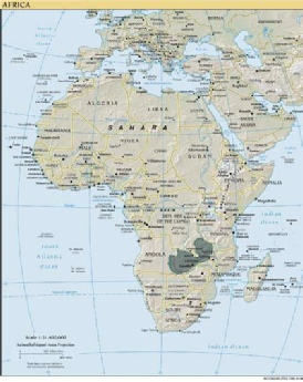
Zambia, a land-locked country in southern Africa, with an area of 290,568 square miles or 752,614 square kilometers, closely matches the size of the state of Texas. Until 1500 this part of Africa remained largely uninhabited. Today the country has a population of about 14 million people, a tremendous increase from a population of less than one million at the time of its occupation by the British in the 1890s. The boundaries of the modern nation of Zambia have virtually no natural geographical or ancient historical roots, but resulted from treaties made between the European colonial powers during the late nineteenth century.
Though Zambia lies in the tropics, the fact that most of the country is a high plateau, ranging from 3,000 to 5,000 feet, moderates the climate. Zambia has a warm, rainy season, which last from about November through March. This is followed by a pleasant period–lasting from March through June–of sunny days in the 70's and 80's. July and August are cool, dry, and can be quite windy. The months of September and October become quite warm as the sun moves south and stands directly overhead. Temperatures are often in the 90's and above, and occasional rains marks the coming of the next rainy season.
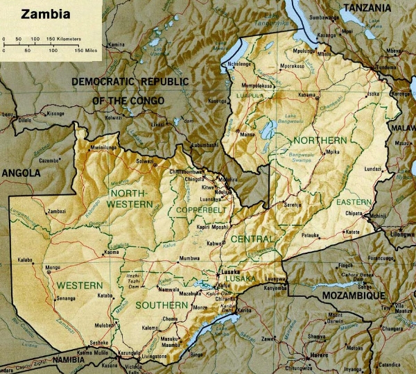
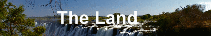
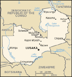
Most of the country is drained by the Zambezi River and its tributaries. The Zambezi drains eastern Angola and runs through the western part of Zambia, which is a mostly flat area of broad sandy plains. At Livingstone, along the border with Zimbabwe, the Zambezi River is about a mile wide. Here, at Victoria Falls, the Zambezi River tumbles over 300 feet into a canyon creating a spectacular waterfall. Some distance below Victoria Falls the Zambezi dumps into Lake Kariba, a man-made lake created by a large dam at Kariba. Below Kariba the Zambezi is joined by the Kafuwe River, which drains the central portion of Zambia. A little further downstream the Luangwa River joins the Zambezi, carrying with it the rainfall runoff from much of the eastern half of Zambia. The Zambezi then enters Mozambique and flows into the Indian Ocean. To the north and west of the Luwangwa River lies a large swampy area around Lake Bangweulu.
Further Information:
World Fact Book by the CIA on Zambia:
https://www.cia.gov/library/publications/the-world-factbook/geos/za.html
Wikipedia article on Zambia:
http://en.wikipedia.org/wiki/Zambia
Zambia Tourism website:
http://www.zambiatourism.com/